Collection: BWCA Canoe Maps
The Boundary Waters Canoe Area Wilderness spans over a million acres of lakes, rivers, and portage trails along the Minnesota–Canada border. True North BWCA Canoe Maps cover the full wilderness — 21 maps from Crane Lake and Lac la Croix in the west to Knife Lake, Basswood Lake, and the Gunflint Trail corridor in the east.
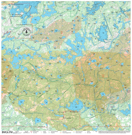
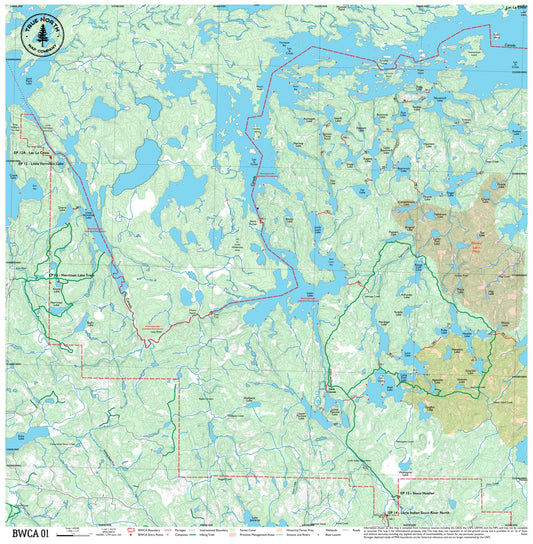
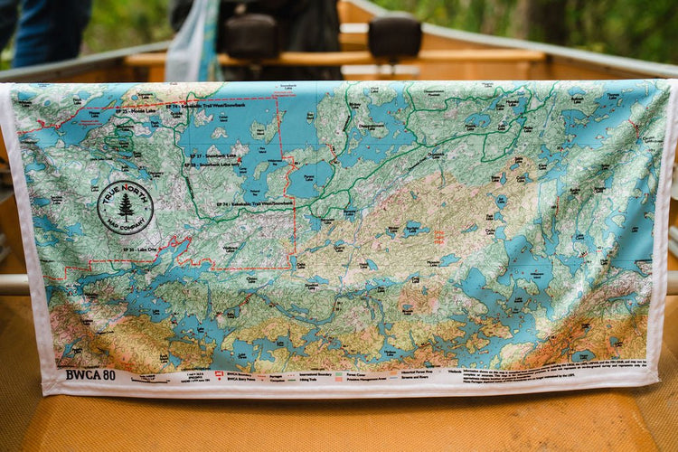
Each map is printed on durable, waterproof cloth — lightweight enough to fold into a shirt pocket, tough enough to survive a week of rain, river crossings, and daily use. No plastic lamination. No tearing. Pull it out soaking wet and it reads just as clearly.
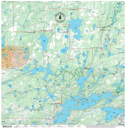
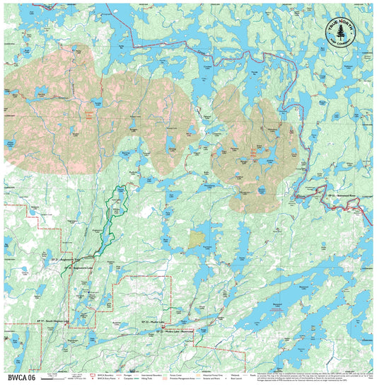
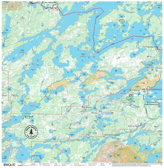
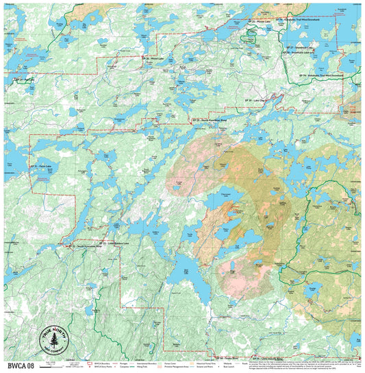
Maps include portage lengths, campsite locations, lake depth contours, entry points, and water routes — everything you need to navigate from put-in to campsite and back. Made using current GIS data from the US Forest Service and updated regularly.
Not sure which map covers your route? Use our BWCA — Which Map Do You Need guide to find the right one by entry point or lake name.
-
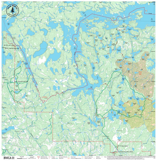
BWCA 01 – Boundary Waters Canoe Area Cloth Map
Regular price $25.00Regular price -
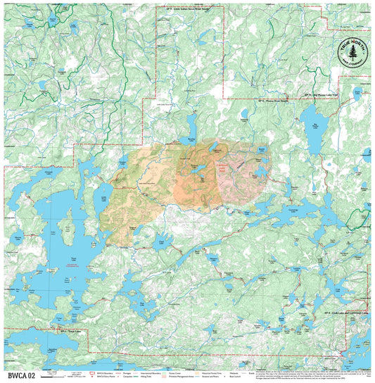
BWCA 02 – Boundary Waters Canoe Area Cloth Map
Regular price $25.00Regular price -
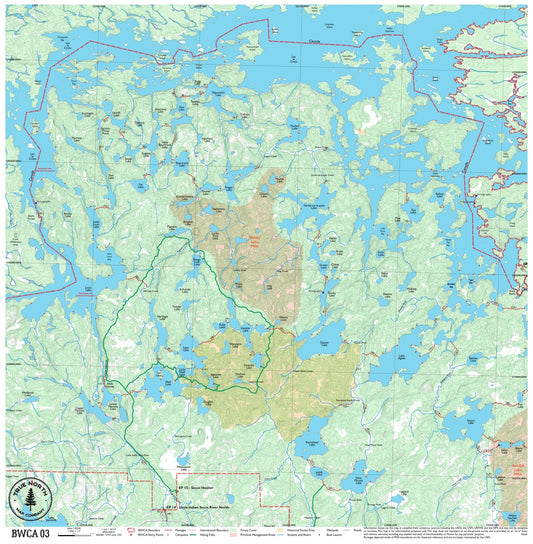
BWCA 03 – Boundary Waters Canoe Area Cloth Map
Regular price $25.00Regular price -
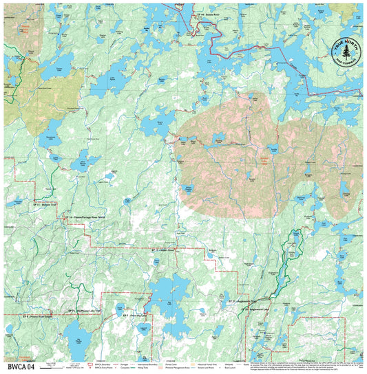
BWCA 04 – Boundary Waters Canoe Area Cloth Map
Regular price $25.00Regular price -
BWCA 05 – Boundary Waters Canoe Area Cloth Map
Regular price $25.00Regular price -
BWCA 06 – Boundary Waters Canoe Area Cloth Map
Regular price $25.00Regular price -
BWCA 07 – Boundary Waters Canoe Area Cloth Map
Regular price $25.00Regular price -
BWCA 08 – Boundary Waters Canoe Area Cloth Map
Regular price $25.00Regular price -
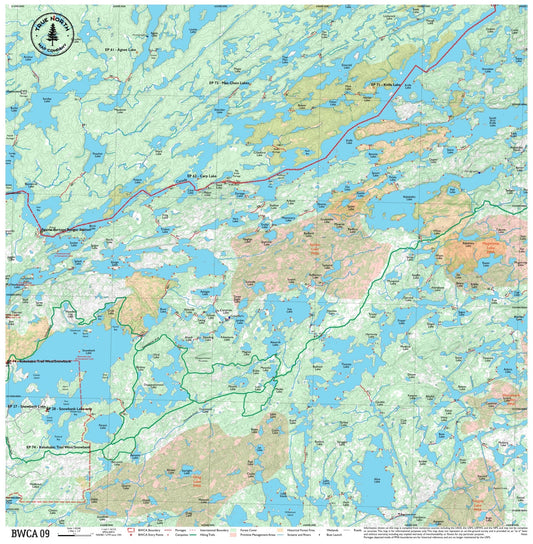
BWCA 09 – Boundary Waters Canoe Area Cloth Map
Regular price $25.00Regular price -
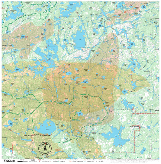
BWCA 10 – Boundary Waters Canoe Area Cloth Map
Regular price $25.00Regular price -
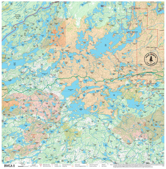
BWCA 11 – Boundary Waters Canoe Area Cloth Map
Regular price $25.00Regular price -
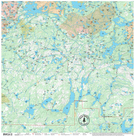
BWCA 12 – Boundary Waters Canoe Area Cloth Map
Regular price $25.00Regular price -
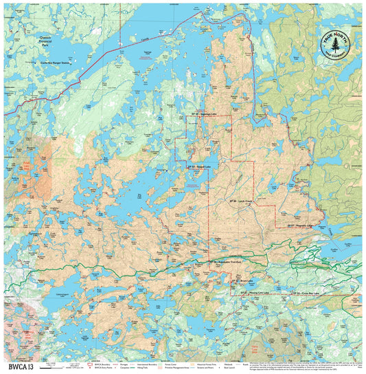
BWCA 13 – Boundary Waters Canoe Area Cloth Map
Regular price $25.00Regular price -
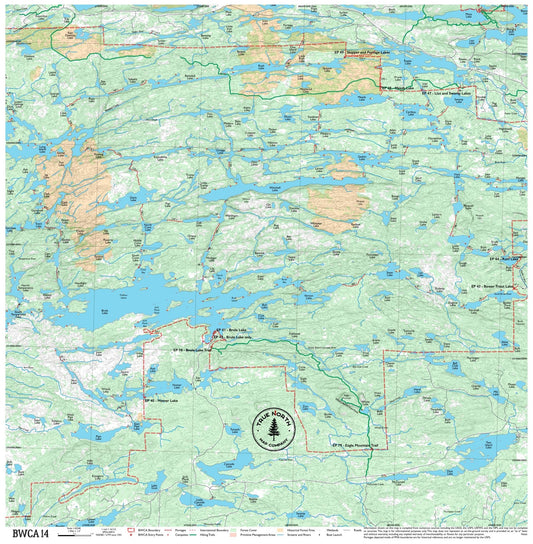
BWCA 14 – Boundary Waters Canoe Area Cloth Map
Regular price $25.00Regular price -
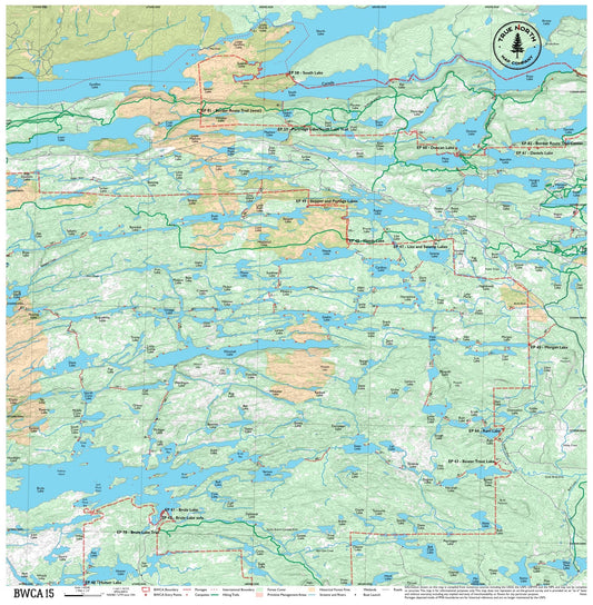
BWCA 15 – Boundary Waters Canoe Area Cloth Map
Regular price $25.00Regular price -
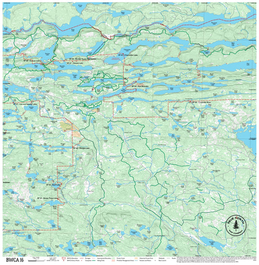
BWCA 16 – Boundary Waters Canoe Area Cloth Map
Regular price $25.00Regular price -
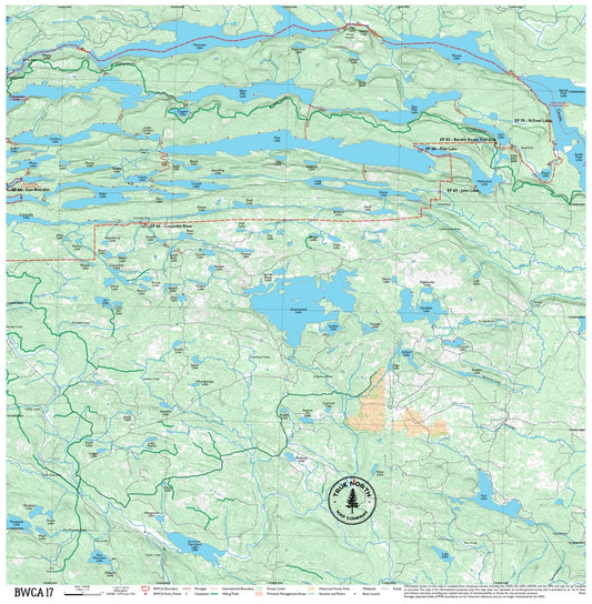
BWCA 17 – Boundary Waters Canoe Area Cloth Map
Regular price $25.00Regular price -
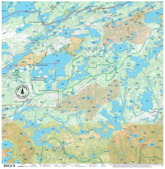
BWCA 78 – Boundary Waters Canoe Area Cloth Map
Regular price $25.00Regular price -
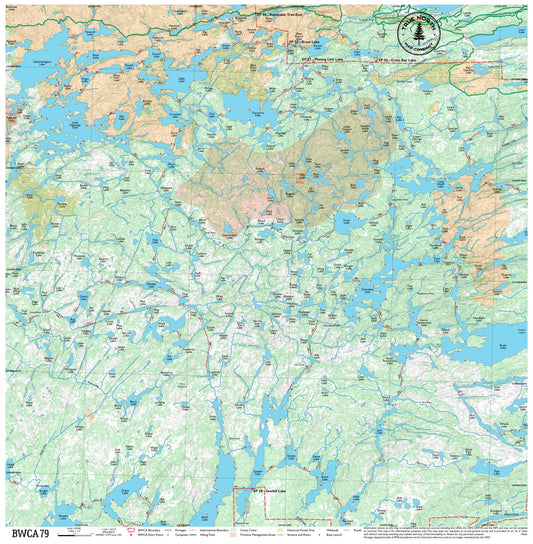
BWCA 79 – Boundary Waters Canoe Area Cloth Map
Regular price $25.00Regular price -
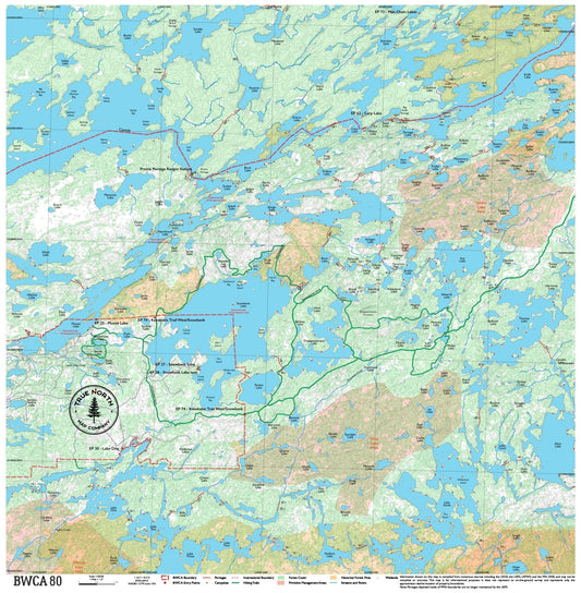
BWCA 80 – Boundary Waters Canoe Area Cloth Map
Regular price $25.00Regular price -
BWCA PW – Boundary Waters Canoe Area Cloth Map
Regular price $25.00Regular price -
Complete BWCA Map Set (1–17) – Boundary Waters Canoe Maps
Regular price $375.00Regular price$425.00Sale price $375.00Sale -
Lake Vermilion – Boundary Waters Canoe Area Cloth Map
Regular price $30.00Regular price