Skip to product information
1 of 1

True North Map Co

BWCA & Quetico Wall Map

BWCA & Quetico Wall Map

Regular price $230.00
Regular price Sale price $230.00
Sale Sold out
Shipping calculated at checkout.
Lamination
Grommets

IMPORTANT: There is as long as a 3 week processing time for all wall maps, due to their configurable and customizable nature. We will make every effort to get them shipped out as quickly as possible.


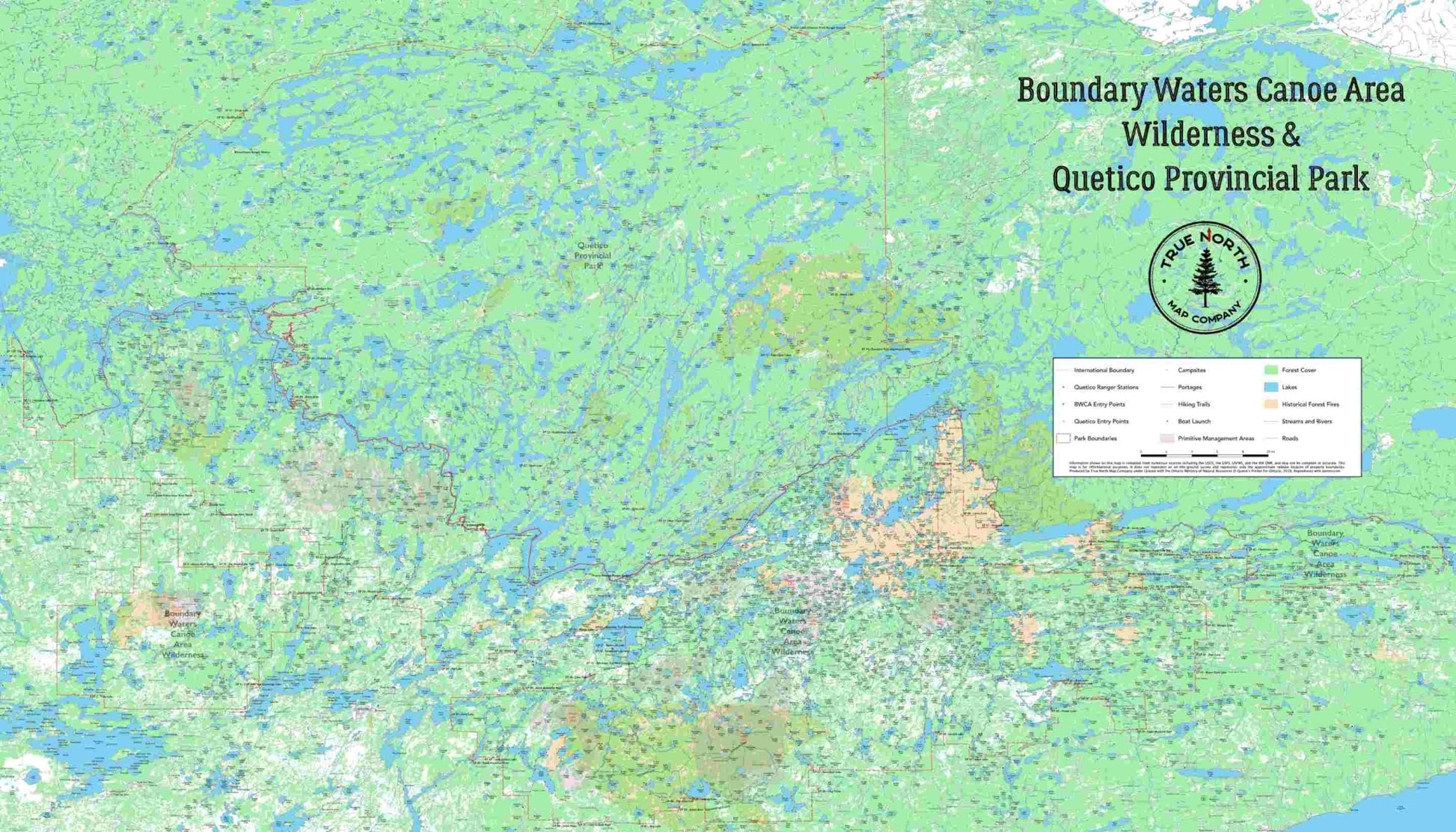
This map covers the BWCA and Quetico Provincial Park in their entirety. 7 feet wide, and 4 feet tall, this is the perfect map to be hung on a wall for planning your future trips into these parks. Using the latest and most accurate GIS data available, this map is functional, and precise. The optional Dry Erase lamination allows you to mark up trips, and change them as plans change.


This map includes the following data:
1. Lakes
2. Rivers and Streams
3. Hiking Trails
4. Portages w/ distance in rods
5. Boat Launches
6. Woodland / Forest Cover
7. Primitive Management Area (PMA) Boundaries
8. Forest Fires within the last 20 years
9. Swamps / Wetlands
10. Landmarks - named features such as bays, narrows and waterfalls
11. Roads

12. Quetico Ranger Stations

13. BWCA Campsites

Print Medium:
DuPont™ Tyvek® - yes, the same material you see wrapping houses during the construction process. This weatherproof barrier is both lightweight, and durable. Its more recently become a popular print media
Lamination:
TYVEK will stand up fine on its own, but for our own personal maps, we wanted something that we could draw and plan and mark up, and then erase. Dry Erase lamination was the solution.
Optional Free Add ons:
Grommets - professionally installed, makes hanging your wall map quick and easy - up to 8 grommets included.


IMPORTANT: There is as long as a 3 week processing time for all wall maps, due to their configurable and customizable nature. We will make every effort to get them shipped out as quickly as possible.

View full details